
The morphopedologic compartments of the Carapina sub-basin, county of Goianápolis, Go
Abstract
Among the sub-basins of the João Leite river basin is that of the Carapina river, elected for this work because it is a plateau (“chapada”) edge area which is representative of the regional geomorphologic and soil patterns, besides being one of those responsible for the water supply for the city of Goiania. The Carapina river basin was sculptured over a great variety of high-grade metamorphic rocks (granulitic facies) of pre-Cambrian age. With the purpose of the diagnosis of the physical environment, several maps were confectioned: the geologic, the hypsometric, the declivity map, and the geomorphologic and soil ones. The crossing of these thematic maps resulted on the morphopedologic compartments map. Four of them were identified: Summit, Summit/Dissected, Dissected, and the lower compartment. The purpose of this work is that of the diagnosis of the physical environment on the basis of the integrated analysis of the rock-relief-soils factors on the different morphopedologic compartments. Considerations about the remaining natural vegetation, the soils erosive susceptibility and on the potential use and current use of the land are done. Key-words: Plateau edge basin; Physical environment diagnosis; Morphopedologic compartments.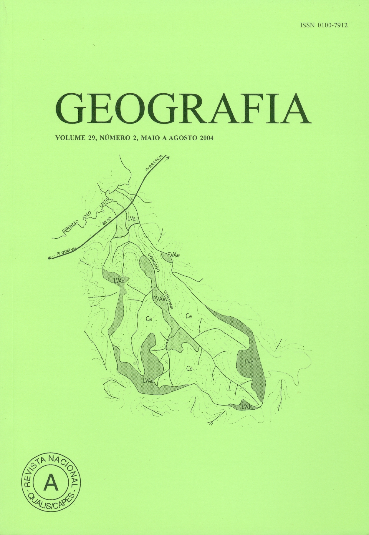
Downloads
Published
2008-02-11
Issue
Section
Article
License
The authors maintain the copyright and grant GEOGRAFIA the right of first publication, with the articles simultaneously licensed under the Creative Commons BY 4.0 License, which allows sharing and adapting the articles for any purpose, as long as appropriate credits and provisions of image rights, privacy or moral rights. Other legal attributions can be accessed at: https://creativecommons.org/licenses/by/4.0/legalcode.en.
Geography, Rio Claro, SP, Brazil - eISSN 1983-8700 is licensed under the Creative Commons BY 4.0 License.


